`Remember me on this computer` option
Select the `Remember me on this computer` option if you wish to be automatically logged on to the computer in future. Your account will remain active for 45 days. Please do not use the `Remember me` option if using a computer with public access or that is used by more than one person.
Seller information

Sold and shipped by
Return of order


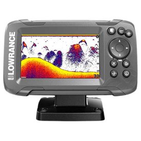
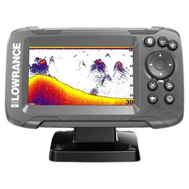
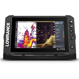
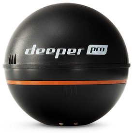
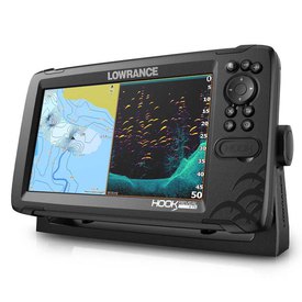
View more related products to:
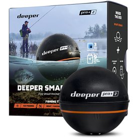
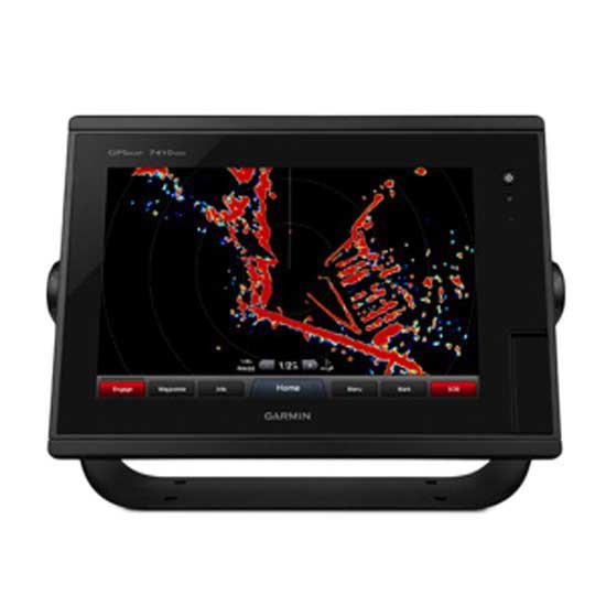
10-inch Multi-touch Widescreen Chartplotter/Sonar Combo
- 10-inch multi-touch widescreen display (1280 x 800 WXGA) with worldwide basemap
- Built-in dual CHIRP sonar plus CHIRP ClearVü and CHIRP SideVü scanning sonar with the clearest images on the water (transducer sold separately)
- High-sensitivity internal 10 Hz GPS/GLONASS
- Fully network capable for Garmin Marine Network and NMEA 2000®, plus NMEA 0183 support
- Supports GSD? 26 professional sonar module
- Designed for power boat users, sailors, racing sailors and fishermen who demand high performance, ease of operation and feature integration, the GPSMAP 7410xsv chartplotter with 10-inch multi-touch widescreen display has a 10 Hz internal GPS that updates position and heading 10 times per second. It is fully network capable, including the Garmin Network and NMEA 2000, and offers the conveniences of built-in Wi-Fi® connectivity.
Add Extras with BlueChart g2 Vision
- With the optional BlueChart g2 Vision, you can add a whole new dimension of exceptional features to your chartplotter.
- MarinerEye view and FishEye view provide a 3-D perspective, both above and below the waterline.
- High-resolution satellite images and aerial photographs help orient you in unfamiliar areas.
- Auto Guidance technology searches through all relevant charts to create a route you can actually follow one that avoids obstacles, shallow water, buoys and other obstructions
Garmin Marine Network and NMEA 2000 Support
- Full-network compatibility allows you to add more capabilities to your boat. GPSMAP 7410xsv supports radar, autopilot, instruments, multiple screens, FUSION-Link, sensors, remote sonar modules, digital switching, thermal cameras, GRID rotary knob, joystick and keypad control, and more. GPSMAP 7410xsv allows you to share features with other compatible GPSMAP units, such as radar, GSD 24, GSD 26 sonar modules, supplemental maps, and user data, including waypoints, routes and tracks. User data entered into 1 chartplotter can be automatically synced with other chartplotters in a network.
Special Sailing Features
- Supported sailing features include laylines, enhanced wind rose, heading and course-over-ground lines, true wind data fields and tide/current/time slider. Gauge displays are designed to provide important need-to-know information at a glance, including true and apparent wind angle, set and drift, true or apparent wind speed, horizontal or vertical graphs, and a data bar with customisable data fields.
Built in ClearVu, SideVu and Traditional Sonar
- The GPSmap 7407xsv provides outstanding fishfinding and bottom tracking capabilities. It offers dual-channel 1kW CHIRP, plus ClearVü and SideVü sonar scanning with CHIRP technology for the clearest scanning images on the water. It delivers target details so clear and precise, you can actually distinguish between small and closely spaced fish at key fishing depths all the way down to 1,500 m.
Heading and Position Refreshed 10 Times Per Second
- Fast, responsive 10 Hz GPS/GLONASS refreshes your position and heading 10 times each second to make your movement on the screen more fluid. It makes dropping up to 5,000 accurate waypoints and finding your way back to them quick and easy.
Compatible with gWind? Transducers
- Garmin gWind, gWind Wireless and gWind Race transducers feature twin-fin technology with 3-bladed propeller. Connect to the NMEA 2000 and compatible Garmin chartplotters via the GND? 10 black box bridge.
FUSION-Link Entertainment System
- Enjoy the ability to control all compatible FUSION-Link-enabled audio systems directly from your compatible chartplotter display.
Enhanced Auto Guidance
- Just enter the location where you want to go and patented Garmin Auto Guidance technology instantly searches through relevant charts to create a safe virtual pathway on the display that helps you avoid low bridges, shallow water and other charted obstructions en route.
- Better still, with enhanced Version 2.0, you now have access to even more features and capabilities. You´re able to adjust the calculated Auto Guidance pathway by inserting ?via? points at interim stops or landmarks along your desired route. You can easily review hazard points along your calculated path. And you can even engage your compatible Garmin autopilot to follow the Auto Guidance route, automatically. Other 2.0 enhancements give you the ability to calculate arrival times at any point on your route (great for timing arrivals to correspond with bridge openings and other time-critical events). Better still, you can now save your plotted Auto Guidance paths for future navigation by backing them up on an SD? card with your BlueChart® g2 Vision® or Lake Vü? HD Ultra cartography¹.
Simplified SOS Calling
- This exclusive SOS safety assist feature makes it easier for anyone even those not familiar with marine electronics or radio protocols to quickly call for Coast Guard help in an emergency. By simply tapping the SOS button on the chartplotter?s touchscreen display, your networked Garmin VHF radio will automatically tune to the Channel 16 emergency frequency and a list of possible situations (Ffire, man overboard, etc.) will be displayed. Once the applicable choice has been selected, the screen will provide a Coast Guard approved VHF radio distress call script, along with the ship?s current lat/long GPS coordinates, that can be read off to responders thus saving time, averting panic, and providing the essential information needed by rescuers to assure the best possible outcome.
GPX Waypoints Transfer
- If you have waypoints, tracks or frequently used routes stored on another manufacturer?s GPS product or on a Garmin handheld device now it´s easier than ever to transfer those items to your new Garmin chartplotter, via industry-standard GPX software formatting. GPX is an open standard format for GPS data exchange across platforms and applications. With this easy-to-use interface technology, Garmin has taken ?no waypoint left behind? to a whole new level of trade-up convenience.
Special Sailing Features
- To help you gain a wind-maximizing competitive edge, your chartplotter features a pre-race guidance page that shows your virtual starting line, along with data fields showing laylines, time to burn before the start and a race timer that can be synchronized across all your networked Garmin GPS products. In addition, other supported sailing features include an enhanced wind rose, heading and course-over-ground lines, set and drift, true and apparent wind data and more. You can also use available built-in wireless connectivity to access and control a variety of marine-specific apps via compatible smartphones or tablets.
Panoptix? Down Transducer
- With 1 Panoptix Down transducer, you get 3 remarkable views, allowing you to actually see fish and bait swimming around under your boat in real time. You can even see fish in the water column in 3-D, from the bottom to the surface. You can be stationary yet still see things in 3-D below your boat.
LIVEVÜ DOWN
- Shows real-time moving sonar images below the boat. This screen shows bait drop echo trail movement in purple with sonar history data at left.
REALVÜ 3-D DOWN
- Scans the area below the boat from front to back and side to side. This screen shows a school of fish sitting against the back side of vertical face, on Pport side of boat 35 feet deep.
REALVÜ 3-D HISTORICAL
- Scrolls through the data as the boat moves to show the history of entire water columns from the bottom to the surface and all of the fish in between. This screen shows the boat passing over a stream channel with a school of fish between 30 to 40 feet.
LIVEVÜ FORWARD
- Updates are provided with a single ping, providing real-time moving images of what´s in the water. This screen shows a large target (a diver) approaching the boat.
REALVÜ 3-D FORWARD
- Digitally scans the area in front of the boat, creating a forward-looking 3-D view of the bottom, structure and fish. This screen shows fish targets at 10 feet and drawing bottom depth of 20 feet.
Create your own HD maps
- Quickdraw Contours is a free, easy-to-use software feature that is already installed on your Garmin. It instantly creates your very own personalised HD fishing maps with 1 foot contours. Tailor them to fit your needs. They´re your maps. You own them. Keep the data to yourself or share it with the Quickdraw Community on Garmin Connect?. There is no special surveying expertise required. You just fish while it creates maps. You Don´t have to wait around or send your files away like other mapping software requires your results appear instantly. Use with any Garmin Panoptix?, any HD-ID?, any CHIRP-enabled, Garmin ClearVü? transducer or NMEA 2000®-compatible depth transducer. Have more than 1 sonar device installed onboard? Quickdraw Contours automatically selects the most capable sonar device to provide the very best results for you!
Multiple Depth Range Shading
- Designate up to 10 different depth ranges each with its own colour. Makes it easier to view target depths at a glance.
Commission Autopilot from Chartplotter
- To make commissioning easier and more convenient, you can handle the entire autopilot commissioning process from your chartplotter screen.
Axis Camera Support
Garmin offers support for select select Axis cameras, which can be used for surveillance and situational awareness on vessels of any size. Our integration allows you to view video on every screen on your boat and, if you wish, view multiple streams on the same screen. You can control your cameras pinch-to-zoom and pan/tilt settings with gestures directly on the plotter screen. Use an Axis encoder to convert analog camera, such as Garmin GC 10, to video over IP.
AXIS and FLIR Camera Support
- Garmin offers support for select Axis cameras, and for select FLIR cameras. These can be used for surveillance and situational awareness on vessels of any size. You can control your cameras pinch-to-zoom and pan/tilt settings with gestures directly on the plotter screen and view video on multiple screens as well as multiple video streams on the same screen. Use an Axis encoder to convert analog camera, such as Garmin GC 10, to video over IP
Catch All the Action On the Water
- This chartplotter supports wireless connections to Garmin VIRB® action cameras so you can catch all the action during your time on the water. More importantly, with a simple software update, you can control recordings, take still pictures, and stream video from a VIRB action camera to your GPSMAP® 7400 series chartplotter or 8000/8400 series Glass Helm chartplotter. In fact, you can stream video from up to 4 VIRB action cameras and view the video on a compatible marine chartplotter. You can even view previously captured images and videos on the chartplotter and display thumbnail previews for easy selection. Control play, pause, seek and replay from your chartplotter. There is even an automatic slide show mode and the ability to delete unwanted VIRB images or videos. Each VIRB can be named for easy identification. You can also control your VIRB cameras to change VIRB video settings, including aspect ratio, video resolution, frames per second, photo size, field of view and more directly from the marine chartplotter. Send NMEA 2000 boat information from the chartplotter to VIRB to be overlaid as G-Metrix? data on the video using VIRB Edit or the VIRB mobile app. Some data requires optional accessories.
The Ultimate Connected Boating App
- The free all-in-one ActiveCaptain? app allows you to manage your marine experience from nearly anywhere. It creates a simple yet powerful connection between your compatible mobile device and your Garmin chartplotter, charts, maps and the boating community. Wherever you are, You´ll have unlimited access to your cartography, the ability to purchase new maps and charts and access to the Garmin Quickdraw? Contours Community. Stay connected with smart notifications on your chartplotter screen. You can also plan a trip or pre-fish a lake, and ActiveCaptain will automatically sync with your chartplotter. Even get notifications for software updates, and decide when to download them on your device.
Specifications:
General:
- Physical dimensions: 28.9 x 20.6 x 7.6 cm
- Weight: 2.36 kg
- Water rating: IPX7
- Display type: WXGA display
- Display size: 21.8 x 13.5 cm; 25.7 cm diagonal
- Display resolution: 1280 x 800 pixels
Power consumption :
- Max power usage at 10 Vdc 30 W
- Typical current draw at 12 Vdc 1.95 A
- Max current draw at 12 Vdc 2.5 A
- Antenna Internal with external connection
- Mounting options Bail, flat or flush
- Receiver 10 Hz GPS/GLONASS
- Garmin Marine Network? ports: 2
Maps & Memory:
- Accepts data cards: 2 SD? cards
- Waypoints: 5,000
- Routes: 100
- Track log: 50,000 points; 50 saved tracks
- Preloaded maps: None
Outdoor Recreation Features:
- Tide tables: Yes
Chartplotter Features:
- Garmin Radar compatible: Yes
- Garmin Sonar compatible: Yes
- Garmin SmartMode compatible (customizable monitor presets): Yes
- Supports AIS (tracks target ships position): Yes
- Supports DSC (displays position data from DSC-capable VHF radio): Yes
- Garmin Meteor? Audio System compatible: Yes
- Supports FUSION-Link? compatible radios: Yes
- GSD? Black Box sonar support: Yes
- GCV? Black Box sonar support: Yes
- BlueChart® Mobile (planning) compatible: Yes
- Garmin Helm? compatible: Yes
- GRID? (Garmin Remote Input Device) compatible: Yes
- Wireless remote compatible: :
Sonar Features & Specifications:
- Dual-frequency (50/200 kHz) sonar capable: Yes
- Dual-beam (77/200 kHz) sonar capable: Yes
- Frequencies supported: 50/77/200 kHz, CHIRP (low, medium, high), ClearVü, SideVü
- Transmit power: 1 kW traditional; 1 kW CHIRP
- CHIRP sonar technology: Yes (Built-in)
- ClearVü: Yes with CHIRP (built-in)
- SideVü: Yes with CHIRP (built-in)
- Maximum depth: 5,000 ft at 1kW (depth capacity is dependent on water bottom type and other water conditions)
- Bottom lock (shows return from the bottom up): Yes
- Water temperature log and graph: Yes
- Sonar recording: Yes
- Sonar history rewind: Yes
Connections:
- NMEA 2000® compatible: Yes
- NMEA 0183 input ports: 2
- NMEA 0183 output ports: 2
- Video input ports: 2 Composite
- Video output ports: 1 DVI-D
- Wireless connectivity: Yes
Additional:
Additional:
- User interface: Multi-touch touchscreen
- Auto backlight dimming: Yes
- Supplemental map sharing: Yes
- Internal sonar sharing: Yes, transmit and receive
- Wifi can only be used with the below compatible Garmin apps.
- Garmin BlueChart Mobile
- Garmin Helm
IN THE BOX:
GPSMAP:
- GPSMAP with worldwide basemap
- Power/data cable
- NMEA 2000® drop cable
- T-connector
- Bail mount with knobs
- Flush mount kit
- Protective cover
- Grommet
- Documentation
- GPSMAP J1939
GPSMAP J1939 with worldwide basemap:
- Built in J1939 connector which offers a dedicated CAN port for receiving engine data
- Power/data cable
- NMEA 2000® drop cable
- T-connector
- Bail mount with knobs
- Flush mount kit
- Protective cover
- Grommet
- Documentation
Garmin GPSMAP 7410xsv J1939 is a product that corresponds to the Gps/fishfinder category within Electronics selection at your nautical and fishing store, waveinn. Wait no more and learn about all the advantages belonging to the community of waveinn. What are the advantages of Garmin GPSMAP 7410xsv J1939? This product is designed specifically to provide good support and entirely based on our passion for nautical and fishing.
Write a review about this product and earn CoINNs 
Write a review about this product
Tradeinn Retail Services as the data controller will process your data in order to respond to your query or request. You can access, rectify and delete your data, as well as exercise other rights by consulting the additional and detailed information on data protection in our Privacy Policy.

30-DAY
EASY & FAST RETURN

SECURE & SAFE
SHOPPING

SATISFACTION
100% GUARANTEED

LOWEST PRICES
GUARANTEED
Related products
Close
ABOUT waveinn

SHOP WITH CONFIDENCE
CUSTOMER SERVICES
4.6 / 5


By Verified Reviews
OUR TRIATHLON CLUB

DOWNLOAD OUR APP


Follow us on


Departments
Top Brands


Copyright 2009 - 2024 by waveinn. TRADEINN RETAIL SERVICES, S.L. CIF/VAT ES-B-17527524, C/ Pirineus, 9, 17460 Celrà (Girona), Spain. Terms & Conditions | Affiliate programs | Cookies policy | Privacy policy | Legal notice | Privacy policy social networks


 Returns
 Help & Contact
 Shops
Shops


 Other sports


 Legal information


 Pay in 3 interest-free instalments.