Sold and shipped by
sales
Free shipping
Return of order


Sustainable
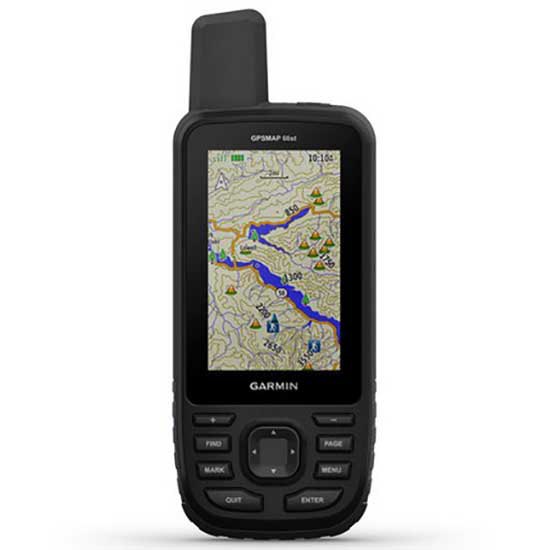
Garmin GPSMAP 66ST GPS
$ 0
RRP:
You save: %
Free shipping
Free assembly
No import duties to be paid.
Sold and shipped by
See other sellers()


Other colors available
Perfect pairings
Reportar error
View more related products to:
Product description Garmin GPSMAP 66ST GPS
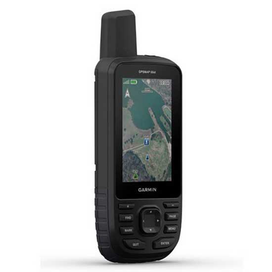
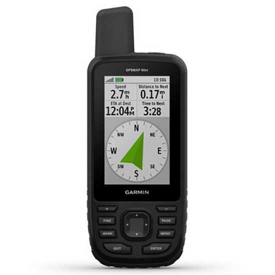
If you count with a device like GPSMAP 66ST, you will get the exact location of the routes of your preference. This device is composed of a 3´´ screen that remains readable despite receiving the impact of sunlight. Inside, it has altimeter, barometer and compass; with these tools you will predict data such as elevations and descents in the road, the climatic changes that may occur and estimate the distance traveled.
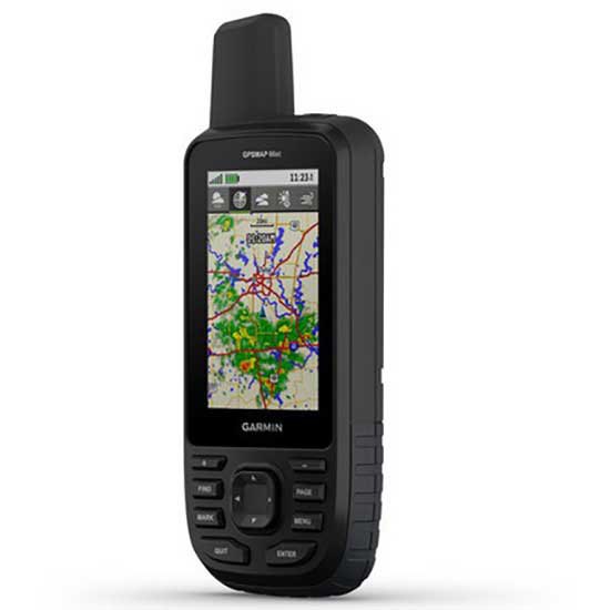
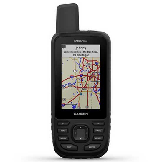
Its connectivity is wireless and allows updating updated and animated weather forecasts. Through the Garmin Explore application, you get interesting information about specific places and know the exact time of the duration of the tours. In addition, you will see satellite images that you can download on your device, at no additional cost. Within its functionalities, you will have access to the topographic maps of the USA and Canada.
If you want to use the LED light of the device you will have 16 hours, but with fewer activities of use its duration will extend to one week.
Premium GPS handheld with BirdsEye Satellite Imagery subscription and TopoActive maps
- Large, 3 sunlight-readable colour display for easy viewing
- Multiple Global Navigation Satellite Systems (GNSS) support to track your travels in more challenging environments than GPS alone, plus three-axis compass and barometric altimeter
- Access to BirdsEye satellite imagery with direct-to-device downloads and no annual subscription, and preloaded TopoActive European maps
- Expanded wireless connectivity supports Active Weather for up-to-date forecasts and animated weather radar, and Geocaching Live for mobile syncing and updates
- Compatible with Garmin Explore website and app to help you manage tracks, routes and waypoints, and review statistics from the field
- LED flashlight function plus up to 16 hours of battery life in GPS mode and 1 week in expedition mode for fewer charges
- Navigate your next outdoor adventure with the GPSMAP 66 series. Whether youre hiking, mountain biking, climbing, geocaching, kayaking or working in outdoor environments, you can explore more with this iconic, rugged handheld with a 3 colour display. It features access to BirdsEye Satellite Imagery subscription with direct-to-device downloads to help you find your way, plus preloaded TopoActive European maps on GPSMAP 66st. And it offers multi-satellite support as well as wireless connectivity for Active Weather, direct downloads and Garmin Explore compatibility.
Get your bearings:
- In addition to multi-GNSS support, the GPSMAP 66 series provides ABC (altimeter, barometer and compass) sensor capabilities to track your journey. The built-in altimeter provides elevation data to accurately monitor ascent and descent, while the barometer can be used to predict weather changes by showing short-term trends in air pressure. The three-axis electronic compass keeps your bearing whether youre moving or not.
See where youre headed:
- Get a better picture of your location with high-resolution photo-realistic views of your route, thanks to direct-to-device downloads of BirdsEye satellite imagery without an annual subscription. Youll see a true representation of your surroundings to find trails, trailheads and clearings for campsites, to find parks and parking for geocaching, and even to create waypoints based on landmarks.
- Plus, GPSMAP 66st comes preloaded with TopoActive European maps. Youll see every hill and valley, with more detail than ever including terrain contours, topographic elevations, summits, parks, coastlines, rivers, lakes and geographical points.
Stay tuned to conditions:
- Youll always stay informed of weather conditions when you pair your GPSMAP 66 series device via Bluetooth® to a compatible smartphone. Receive Active Weather updates for real-time forecast information, including predictive maps for temperature, wind, precipitation and clouds. It also provides live weather radar so youre aware of inclement weather that can affect your outdoor adventures.
Find your cache:
- GPSMAP 66s and GPSMAP 66st devices make it easier than ever to enjoy your geocaching experience. Set it to automatically update with all the latest caches from Geocaching Live, including cache descriptions, logs and hints. With a Wi-Fi® connection or through Garmin Connect on a compatible smartphone, youll avoid manually entering coordinates or printing out cache details on paper and each find will automatically upload to your profile.
Explore with Garmin:
- Even when youre offline and have no mobile connection, the GPSMAP 66 series pairs with the Garmin Explore mobile app to let you plan, review and sync data, including waypoints, routes and tracks. Plus, you can review completed activities while still in the field, even when youre off the grid.
Utility in adverse environments:
- Be prepared for the most extreme adventures. The GPSMAP 66 series offers up to 16 hours of battery life in GPS mode and 1 week in expedition mode (with two AA batteries) for fewer charges. It provides an LED flashlight and SOS beacon that can be used to signal for help. Its built to military standards for thermal, shock and water performance (MIL-STD-810G), and its even compatible with night vision goggles.
Specifications:
General:
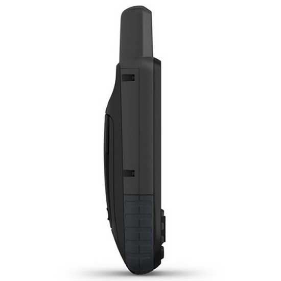
- Physical dimensions: 6.2 x 16.3 x 3.5 cm
- Weight: 230g with batteries
- Water rating: IPX7
- Battery: 2 AA batteries (not included); NiMH or Lithium recommended
- Display type: Transflective colour TFT
- Display size: 3.8 x 6.3 cm; 3 diagonal
- Display resolution: 240 x 400 pixels
- Memory/history: 16 GB
- High-sensitivity receiver:
- Interface: High-speed USB and NMEA 0183 compatible
Maps & memory:
- Ability to add maps: Yes
- Basemap: Yes
- Storage and power capacity: microSD card (not included)
- Waypoints/favourites/locations: 10,000
- Routes: 250
- Track log: 20,000 points, 250 saved gpx tracks, 300 saved fit activities
- Preloaded maps: Yes (topographic)
Sensors:
- Barometric altimeter: Yes
- Compass: Yes (tilt-compensated 3-axis)
Outdoor recreation features:
- Area calculation: Yes
- Automatic routing (turn by turn routing on roads): Yes (with optional mapping for detailed roads)
- Geocaching-friendly: Yes (Paperless)
- Custom maps compatible: Yes
- Hunt/fish calendar: Yes
- Sun and moon information: Yes
- Camera: No
- Picture viewer: Yes
Garmin Connect:
- Garmin Connect compatible (online community where you analyse, categorise and share data): Yes
Additional:
- Garmin Explore compatible: Yes
- Garmin Connect IQ compatible: Yes
- Wireless compatible: Yes (Wi-Fi, Bluetooth and ANT+)
- Map segments: 15,000
- Active weather: Yes
- Smart Notifications: Yes
- Live Tracking: Yes (with) Garmin Connect Mobile
- BirdsEye direct to device: Yes (no annual subscription required)
- MIL STD 810G ruggedness for thermal, shock and water performance
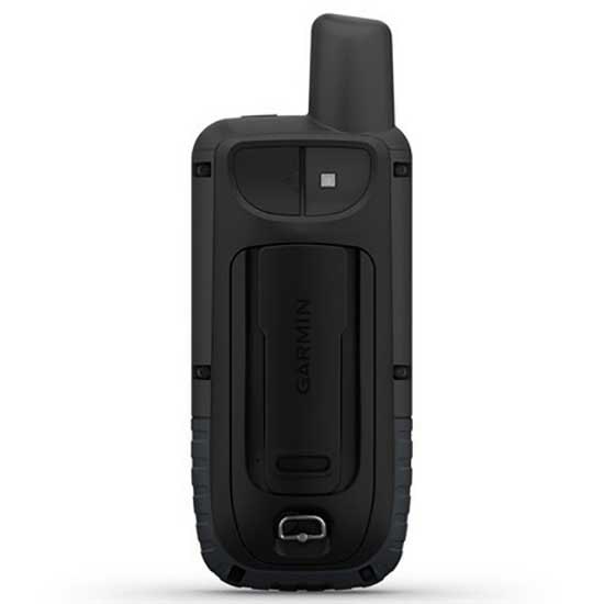
In the box:
- GPSMAP 66
- Access to BirdsEye satellite imagery (no subscription required)
- USB Cable
- Carabiner with clip
- Documentation
Garmin GPSMAP 66ST GPS is available in different options and characteristics. Choose the one that fits your needs the best and receive it at home in a few days. In addition, in the online outdoor store you can find Garmin GPSMAP 66ST GPS related products. Our selection of Handheld GPS products are designed to give you complete confidence, no matter of the intensity of the workout or sport activity.
Features Garmin GPSMAP 66ST GPS
Technology Garmin GPSMAP 66ST GPS
Sustainable Garmin GPSMAP 66ST GPS
More information |
Experts review. Garmin GPSMAP 66ST GPS
This product is also sold by
Best sellers
Complete your basket
Related products
Write a review and earn CoINNs
5 / 5
3 Reviews
5 stars
100%
4 stars
0%
3 stars
0%
2 stars
0%
1 stars
0%

Gps all-time
19/08/2019
Barri
It is a GPS for use in summer and especially in winter, for use by keys with gloves. Very configurable in terms of menu preferences. Its use requires a certain technological skill. Its software is updated by Wi-Fi and maps are passed by Bluetooth from Wikiloc. Very good synchronization with the mobile. Nobody expects the fluidity of a mobile because this is what it is for. Still, more than enough. Very very happy.
My purchase of garmin gpsmap 66st
12/05/2019
Alejandro Faraldo
I am very happy with the purchase, although the maps it allows to install are still very basic. I have the Garmin gpsmap 60Csx, but it has become obsolete, with new programs and improvements in features. Next step buy the maps, more updated as: Garmin TOPO Spain v6 PRO.
Very good gps for mountain
15/02/2019
Alfonso
Robust, reliable and very good screen visibility. At the beginning, it costs a bit to get used to the menus and options through the keys since it has many options and configurations. But the one you get used to is very powerful. Very good buy. On the part of Trekkin I send it in perfect time and without problems. I have already made several purchases with them and everything is correct.
Write a review about this product
Answer the question
Write your answer
The question has already been answered, thank you very much for trying to help another customer. We will count on you for future questions.
Tradeinn Retail Services as the data controller will process your data in order to manage and process your order. You can access, rectify and delete your data, as well as exercise other rights by consulting the additional and detailed information on data protection in our Privacy Policy.
Somewhat disappointed
23/07/2019
JUAN CARLOS
For a neophyte like me in dedicated GPS, but with great experience in applications for GPS on mobile phones and tablets has been a step backwards of at least 2 decades. It is as if I change the Iphone 6 that I have for a Nokia keys 20 years ago. I recognize that the possibilities of the Garmin GPSMAP 66st are superior to those of mobile phones both in precision (I have not checked the phones with dual GPS) and in possibilities, resistance, display and battery. But I make a strong criticism that these devices in 2019 should be much more agile than they are and the interface is quite cumbersome and not intuitive. Therefore, I doubt if I was wrong to buy a GPSMAP 66st instead of an Oregon 750, since with similar price and features, the Oregon is touch screen and therefore must be more intuitive and agile. Regarding the GPSMAP 66st it is not worth it with respect to the 66s, since the Topoactive map of Europe that it includes does not have contours, I suppose that who buys a GPS of these characteristics assumes that the contours are basic, therefore you You can save 40 euros over 66st compared to 66s. You can get the maps from the OpenMap download pages that are free and great and of course with contours. Another aspect that inclined me to buy this model was the possibility of downloading via satellite the satellite images, this aspect works well but I was disappointed by the low resolution of the images (nothing to do with the aerial images of Google or Wikiloc) and by the download procedure that is slow and impractical. Another aspect that I didn't like about Garmin is the lack of information about everything. For example, applications such as Base Camp, Garmin Manager and Garmin Install, which are basic for map management, and which I have had to inform thanks to other users. The compatible APPs like Connect IQ and Explore are quite simple and at the same time confusing, as of today I see them of very little use except for Wikiloc with Conect IQ that allows you to download the routes directly to the GPS although with a slow transfer. In summary, although I do not regret the purchase, I consider that for the price you have, you should have a more powerful microprocessor and that the use of GPS, especially when moving the map on the screen, should be much more agile. As for the menu and keys, it will be a matter of learning it well. The 3 inches of screen I see insufficient, probably because I am badly used by tablets and mobile phones with GPS:)
Ask a technical question about this product
Tradeinn Retail Services as the data controller will process your data in order to manage and process your order. You can access, rectify and delete your data, as well as exercise other rights by consulting the additional and detailed information on data protection in our Privacy Policy.


